Mobile Development
Business
mobileapp
apps
app
maps
navigation
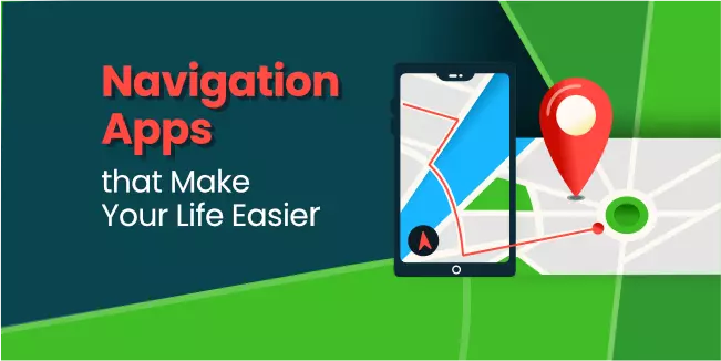
Navigation Apps that Make Your Life Easier
The development of technology contributes to making life easier for ordinary people. There are many mobile applications whose purpose is to help with everyday duties and also make you have an excellent time, e.g., listening to music or doing your hobby.
Every app starts with a great app idea that can be turned into a real monetized product. As a software development company, we know the mobile app development process is a big challenge, but the effects bring great satisfaction.
We have prepared a list of navigation apps for you, which also started with a great idea. Thanks to this list, we hope it will be easier for you to choose the application that best suits your needs.
Why are Navigation Apps so Popular?
Can you remember the last time you drove to a new place without using a navigation app? Or when was the last time you used a paper map on the road? Well, it was probably so long ago that you don't even remember it. And no wonder. According to emarketer.com, more than 90% of US consumers under 50 regularly use GPS apps. Navigation apps owe their popularity to the development of technology because it is technologies that have made navigation applications accurate, convenient to use, and widely available.
Navigation applications are constantly developing, and new features appear, such as speed camera warnings, traffic data, or route planning. In addition, some of these applications began to specialize in meeting the specific needs of users. For this reason, apps are available that are ideal for hiking, outdoor sports, or helping deliver goods.
Most of the GPS navigation apps available on the market offer a free version and allow you to download maps, thanks to which offline navigation is possible.
This article has prepared a list of navigation applications for you to choose from that perfectly meet your needs. Some of these apps are available for all operating systems, but there are also Android-only or iOS-only apps.

Google Maps are the most popular of all navigation apps. This application was created by Google, which has been doing its best for years to ensure the service is accurate and constantly updated.
Google has many vehicles and backpacks worldwide equipped with specialized cameras and GPS devices, thanks to which it constantly verifies and updates the data available in the application. In addition, it adds various features all the time that make the app combine several different apps. For example, with Google Maps in some cities, you can pay for parking without having to install a separate application for paying for parking.
Google Maps has spoken directions for street names, street view images, real-time traffic detection, avoidance, and other features, too many to list here. It's an app that works while driving and offers accurate and up-to-date directions for walking, public transport, and cycling routes, including bicycle paths and bike-friendly roads. Also, users can contribute to Google Maps by adding new or missing roads, uploading photos, and writing reviews about local businesses.
As hard as it is to believe, Google Maps has its downsides. If you're planning a route with multiple stops, Google Maps will find the best route from one point to another, but it won't optimize the entire route. In addition, Google Maps cannot add more than 10 stops to a route, making it not the first choice for goods suppliers and field salespeople.
It is worth noting that Google Maps is a free GPS app available for Android and iOS; however, Android Google Maps have more supporters.

Waze, also owned by Google, focuses mainly on car travel.
Waze allows users to share real-time travel information, including traffic, obstacles, accidents, and other notifications. It will enable you to make more informed decisions about choosing a route. Unlike most applications, it gives reasons for traffic delays described by other drivers.
The downside is too many icons showing obstacles/roadworks/traffic jams that obscure the map view. In addition, many people do not like notifications with sounds they receive when someone enters a route announcement. Because the application updates the route data on an ongoing basis, it heavily burdens the phone's battery.
Like Google Maps, Waze offers free offline maps and works on Android and iOS devices.

MapQuest is an accurate navigation application that has many exciting features. In addition to the usually spoken directions, it includes a speed limit display, live traffic camera feeds, and search integration. Unlike Google Maps, it is possible to add up to 26 stops along the route, and the application can still propose the most optimal way between these points. Of course, MapQuest has real-time traffic jam detection and avoidance and the ability to automatically send your estimated arrival time to the person you're going to.
The basic version of the application is free. Still, users sometimes complain that pop-up ads cover the screen, so investing a few dollars in the paid version is better. However, the most significant disadvantage of this application is that it only works online, so if you have problems with the Internet while traveling, the application will not work.
MapQuest is available for iOS, Android, and Windows Phone devices.

It's Google Maps' biggest rival as it comes pre-installed on iPhones and other Apple products.
Like all the company's products, Apple Maps is extremely simple and intuitive. It provides features such as turn-by-turn directions and voice navigation. The screen shows information about the weather and air quality at your destination. It also tells you the fastest way to reach your goals based on traffic, location, and time of day. Unfortunately, the most exciting Look Around feature for exploring cities in a 3D environment is only available in 5 countries.
Unfortunately, the app does not offer the option to use maps offline.
As the name suggests, the app is only available on iOS devices.

It is a great application, perfect for lovers of hiking, cycling, sailing, and all outdoor activities. Polaris GPS Navigation adds detailed data based on information from other navigation services such as Google Maps, OpenStreetMap maps, MapQuest, and bike route maps. It has a compass, sunrise and sunset tracking functions and GPS satellites, a track recording function, and many amenities that will please lovers of active leisure.
t is not an application for everyday use, but it is worth downloading if you go on a trip. Just remember that most features require an Internet connection.
Polaris GPS Navigation is only available for Android devices. The basic version is free, but the premium version (with extra features and no ads) Polaris GPS Navigation price is $5.

It is an application dedicated to globetrotters because its great advantage is high-quality maps from around the world for offline use.
Without an Internet connection, all essential functions, such as the search function, navigation, or the ability to find a restaurant or bank. Also, the app consumes less battery than other apps that need to be online.
The undeniable advantage of Maps.me over other GPS applications is that the maps are updated daily by millions of individual users, which makes this application extremely reliable.
The downside is that data on the location of companies/restaurants/shops should be updated more often, and the application's interface could be more user-friendly.
The application is free and available for Android and iOS users.

It is an application for real travelers who, when planning their route, consider the height and curvature of the road or exact weather conditions. You can export maps to other applications, and with the ability to add addresses as a start, waypoint, or destination pins, InRoute Route Planner is one of the best ways to create multiple routes with multiple stops at once. The free version of the app allows you to plan a route with up to 8 locations.
This app lacks traffic alerts; however, it has excellent features ideal for motorbike rides, RV, and truck tours.
The paid version includes additional features such as voice navigation. The application is only available for iOS devices.

It is an exciting application in which you can plan a route not only for cars but also for campers and trucks. CoPilot GPS has data on, for example, the width of roads or low clearances under bridges or viaducts. By entering the type of vehicle and its parameters, the application searches for the most optimal route.
The application works offline and allows you to search for points such as restaurants or gas stations.
The basic version of the application is free. Still, you must pay for the version with additional features such as offline voice navigation, route planning, and traffic information. The price depends on the type of vehicle.
CoPilot GPS is available for both Android and iOS devices.

It is an application created by the manufacturer of GPS devices. It is available offline and compatible with Apple CarPlay. TomTom Go offers real-time traffic information, voice navigation, and 3D maps. It contains maps of 150 countries and warns against radars (in countries where it is not prohibited by law).
You can only use the app for free for the first 50 miles once a month. Then you need to subscribe for a month or a whole year.
Some users feel the application could load faster, and the search function needs to be refined.
Android and iOS users can use it.
Summary
Using navigation apps certainly makes life easier. Currently, most people cannot imagine traveling or practicing sports without them.
There are many applications, so choosing the one that will suit your needs and expectations is essential.
And if you would like to create a mobile application, we will be happy to help you. We have been developing successful mobile applications for over a dozen years and are delighted to share our knowledge and experience.